Test yourself on River Processes and Landforms with exam style questions, marked instantly.
Flashcards that come back just before you would forget them.
A revision plan that remembers what you know and shows what to do next.
See which topics you have nailed and which need another look.
Quiz yourself on River Processes and LandformsGet your flashcardsBuild my revision planTrack my progress🔍 The Three Courses: An Overview
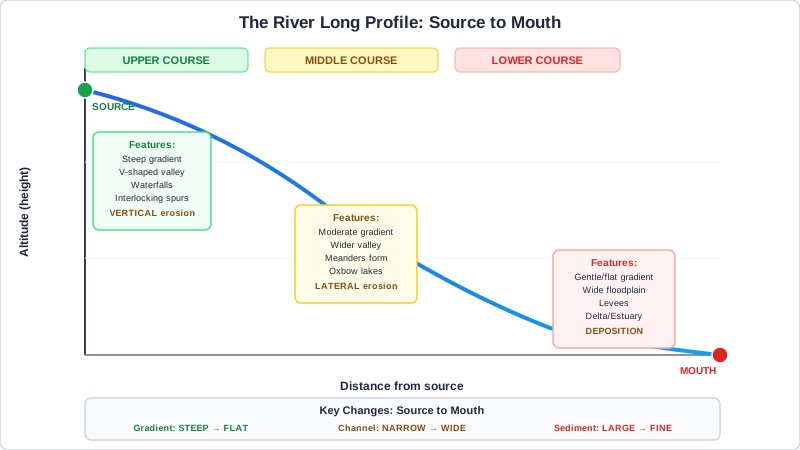
Figure 1: River Long Profile — how gradient, channel shape and dominant processes change from source to mouth
Every river can be divided into three sections — the upper course, middle course and lower course. These are not just geographic zones; they are zones of completely different processes, shaped by the balance between the river's energy and the resistance of the landscape it flows through.
| Feature | Upper Course | Middle Course | Lower Course |
|---|---|---|---|
| Gradient | Steep | Moderate | Gentle |
| Channel | Narrow, shallow | Wider, deeper | Very wide, deep |
| Flow speed | Turbulent (appears fast) | Moderate | Slow but high velocity |
| Dominant process | Vertical erosion | Lateral erosion + transport | Deposition |
| Key landforms | V-valleys, waterfalls, gorges, interlocking spurs | Meanders, river cliffs, point bars, floodplain developing | Meanders, ox-bow lakes, floodplains, levées, deltas |
| Load character | Large, angular boulders | Mixed — cobbles, gravel, sand | Fine silt and clay |
The gradient drops most sharply in the upper course and flattens as the river approaches the sea. This profile — steep at the top, gentle at the bottom — is called the long profile or graded profile. Rivers constantly work towards a smooth, idealised long profile; every landform is a stage in that process.
Make this stick
Signing in gives access to all PrepWise features.